Hot Templates
popchallengePixel style filterMrcomfort flipbooki2ii2i comai in businessi2i healthdeepmind aii2i population health revenuei2i websiteMermaid AIpredictionwallpaper Import photos or videosPhotos can be removedTry this wallpapePredict Child AIhow can i crop something out of a picturecan you edit blemishes on iphonehow can you photoshop someone out of a picturecan you photoshop someone out of a picture
Free world map satellite zoom Templates by CapCut
Add new video
00:14
82.6k
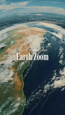
Earth Zoom Trend

00:11
28.7k
Trend zoom earth

00:47
72
Yet another meme :3

00:14
9.6k
Earth zoom edit

00:14
1.9k
Zoom earth trend
popchallenge
Pixel style filter
Mrcomfort flipbook
i2i

00:17
13
earth zoom template

00:22
3.9k
zoom in trend

00:13
2.5k
Earth zoom

00:15
15.2k
EARTH ZOOM

00:11
1.2k
Earth zoom

00:13
10.6k
Earth zoom trend

00:09
1.2k
EARTH ZOOMING IN

00:20
2.7k
ZOOM IN EARTH TREND

00:11
49
Earth zoom trend

00:15
1.3k
EARTH ZOOM
00:15
2.4k
earth zoom trend
00:10
29.3k
Earth Zoom

00:16
8.6k
Earth Zoom intro