Free Google Earth Timelapse Templates By CapCut
Google Earth Timelapse lets you visualize the dynamic changes of our planet from 1984 to the present. Discover how landscapes, cities, and environments have evolved using detailed satellite imagery brought to life through interactive time-lapse videos. Ideal for educators, students, researchers, and anyone curious about climate change, urban growth, or environmental transformations. With user-friendly navigation, you can easily zoom in on your region of interest, compare past and present land features, and gain new insights into the impacts of natural and human activities on Earth. Experience the power of visual storytelling with Google Earth Timelapse and broaden your perspective on global development and environmental conservation.
More Templates


39K
Pub crowd goes craz

38K
Breaking News

29.5K
Reação gol

28.2K
crowd goes crazy

13.5K
mundo zoom1 edit

11.6K
google search trend🧸
11.2K
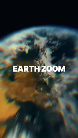
Earth zoom
10.2K
google earth

9.8K
google earth

8.2K
TIME SLOWED

8.1K
working gs clock

6.5K
Weirdest Person

6.4K
u and me belong tgth

5.9K
Clock Coming Soon 🕥⏱️
5.6K
Viral🔥

5.1K
Gmaps Template 2

4.3K
Earth Zoom Out AI

2.9K
Streetviewtemplate
423
Earth Best Intro
1
Hot Templates
Template By CbpngNew Template 2026 ProBlack TemplateBlur Video TemplateTemplates For PhotosPhoto TemplatesTentana MontageFree TemplatesLoading TemplateCute TemplatesText Effects TemplatesNew Template 2026 SadZoom Animation EffectsNew Templates 20268K Video Editing 2026Template AestheticOrbit4K Video Editing 2026Name Title Template30 Seconds Video TemplateVideo 2026Templates 20261 Minute Video Template1 Clip Video TemplateArabic TemplateUnknown Montage30 Second Video TemplatePhoto Edit Trending 20263D Special EffectsGolden Brown5 Clips Video Template3 Clips TemplatePhoto Editing TemplateKeying TemplateFree Sound Effects DownloadSubtitle TemplateAa23 Template3 Photo TemplateFestival TemplateVideo Blur25 Seconds Video Template4K Video Editing 2026 Telugu3 Photos Template24 Second Video TemplateBackground Blur Video TemplateBubble TemplatesTemplate Trending New 2026Holi VideoFree Video Without WatermarkOut Of This Planet
About google earth timelapse
Google Earth Timelapse lets you visualize the dynamic changes of our planet from 1984 to the present. Discover how landscapes, cities, and environments have evolved using detailed satellite imagery brought to life through interactive time-lapse videos. Ideal for educators, students, researchers, and anyone curious about climate change, urban growth, or environmental transformations. With user-friendly navigation, you can easily zoom in on your region of interest, compare past and present land features, and gain new insights into the impacts of natural and human activities on Earth. Experience the power of visual storytelling with Google Earth Timelapse and broaden your perspective on global development and environmental conservation.